| Offers the possibility to obtain the necessary skills for creating databases and descriptive cartographic representations or regional and urban contexts at various scales. The activities of Lcart are aimed particularly to the acquisition, conservation, production and publication of databases and cartographic documentation; it allows experimenting, perfecting, and practicing innovative forms of acquisition, treatment, visualisation and diffusion of geographical information. The Laboratory offers the possibility to plan, design, carry out research and provide services in the field of the GeoICT for external contractors, both public and private; it also provides support and collaboration to research, planning and design activities within the system of Departments.
Opening hours
Open to the public:
Monday and Friday 9:30 - 12:30
Works and research
Data Analysis
-
2015
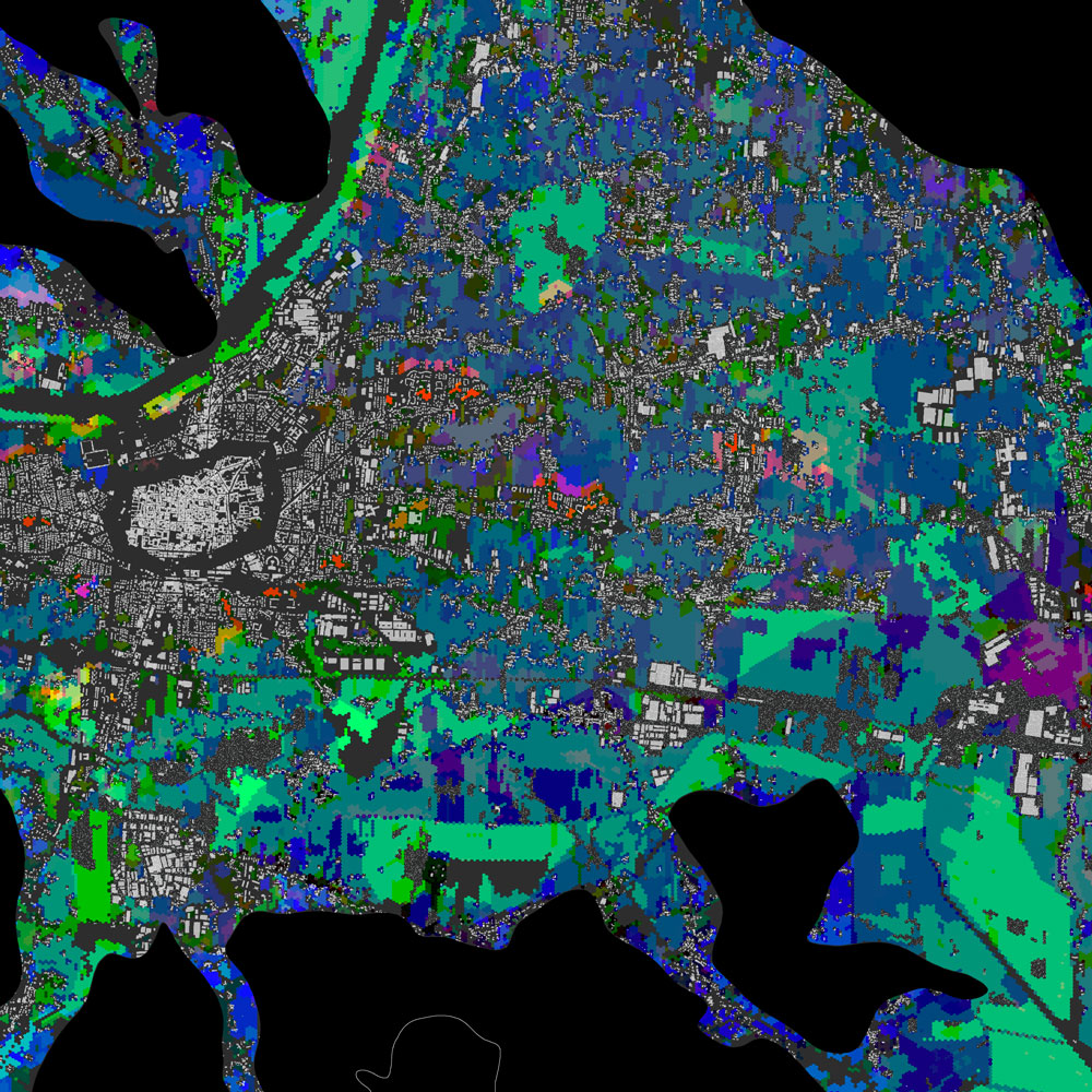
ASSESSMENT OF LAND
USE MODIFICATION
WITH LCF MODEL
-
2014
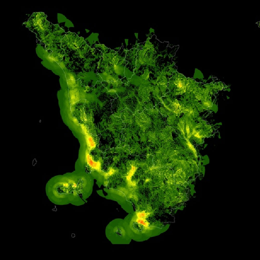
MAP OF ECOSYSTEM
SERVICES OF THE
PROVINCE OF LUCCA
Data bases
-
in process
CATALOGUE OF NAMES OF
TUSCAN PLACES TAKEN FROM
PRE-UNITARY CADASTRAL FOLIOS,
IGM MAPS AND CURRENT
CADASTRAL FOLIOS
-
2014
INTERVISIBILITY
FOR LANDSCAPE PLANNING
-
2012
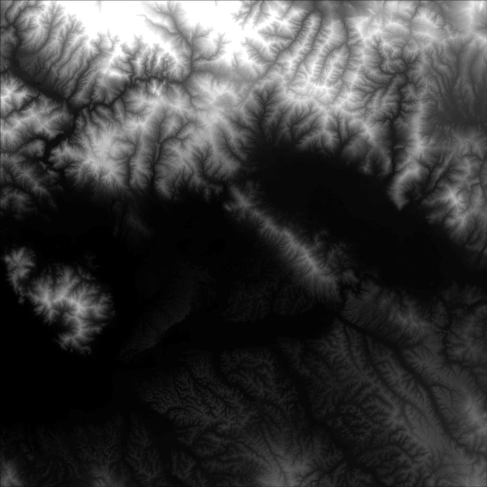
DIGITAL MODEL COVERING
THE ENTIRE TERRITORY OF
THE TUSCAN REGION
-

2008
DATING OF BUILT SEDIMENTS
IN THE TUSCAN REGION FROM
EXISTING CADASTRAL AND
AEROPHOTOGRAPHIC SOURCES
Cognitive Frameworks
-

in process
TERRITORIAL INTERFACE
OF THE PORT OF LIVORNO
-

in process
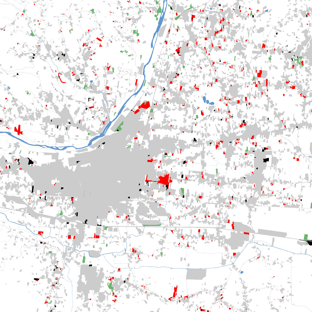
LAND CONSUMPTION MEASUREMENT
AND ANALYSIS OF PLANNING
STRATEGIES FOR URBAN RECOVERY
AND THE REGENERATION
OF DEGRADED AREAS IN THE
MUNICIPALITY OF PISTOIA
Cartography
-

2013
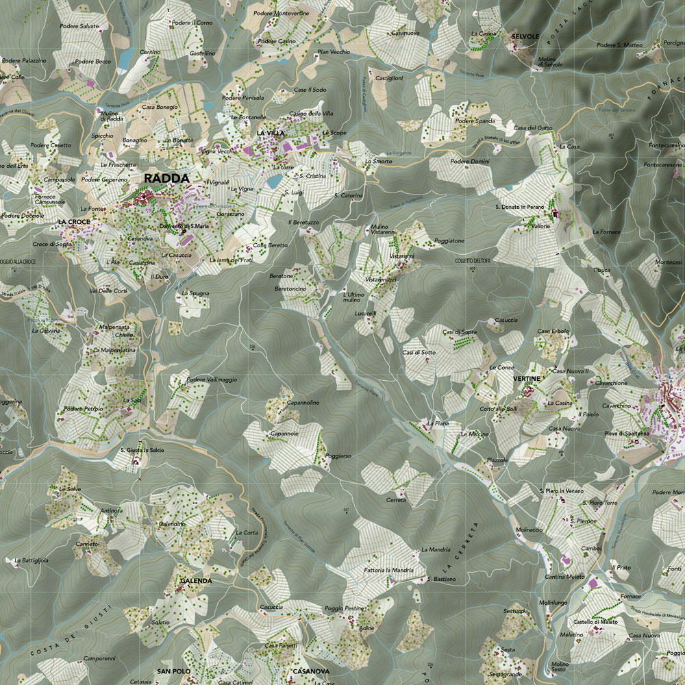
TOPOGRAPHIC MAP
OF TUSCANY
-

2013
MAP OF THE LANDSCAPE
CHARACTERISTICS IN THE
TUSCAN REGION
Diffusion
-

2011
ANTHOLOGICAL ATLAS OF
THE VAL D'ORCIA LANDSCAPE
-

in process
REGIONAL CHARACTERISTICS
OF THE GARFAGNANA
Recent Publications
- Fabio Lucchesi, Christian Ciampi, Fabio Nardini, Ilaria Scatarzi La carta dei caratteri dei paesaggi toscani. Mapping the Landscape Identity in Tuscany. BOLLETTINO DELL'ASSOCIAZIONE ITALIANA DI CARTOGRAFIA (ISSN 0044-9733), 59-74 (article in review)
- Fabio Lucchesi, Michela Moretti, Christian Ciampi, Michele Ercolini, Michele De Silva, Emanuela Loi, Fabio Nardini, Ilaria Scatarzi, I quadri paesaggistici e le condizioni di intervisbilità: le valutazioni realizzate per il Piano Paesaggistico della Regione Toscana In: Atti 18a Conferenza Nazionale ASITA, Florence, October 2014. Federazione Italiana delle Associazioni Scientifiche per le Informazioni Territoriali e Ambientali, (ISBN 9788890313295) 793- 800 (contribution at the conference)
- Alfonso Dodero, Fabio Lucchesi Zenitale e obliquo. Cartografia del paesaggio e visualizzazione tridimensionale In: Atti 18a Conferenza Nazionale ASITA, Florence, October 2014. Federazione Italiana delle Associazioni Scientifiche per le Informazioni Territoriali e Ambientali, (ISBN 9788890313295) 431- 438 (contributon at the conference)
- Iacopo Zetti, Fabio Lucchesi Ritratti regionali. Un indicatore di polinuclearità dei sistemi insediativi. In: Atti 18a Conferenza Nazionale ASITA, Florence, October 2014. Federazione Italiana delle Associazioni Scientifiche per le Informazioni Territoriali e Ambientali (ISBN 9788890313295) 1041- 1047 (contribution at the conference)
Traineeships
The Laboratory envisages vocational and educational activities, including traineeships related to the research agreements in process, up to a maximum of three trainees at a time.
|
Scientific Director
Fabio Lucchesi
Palazzo San Clemente
Via Micheli, 2
Firenze
tel. 055 2756465
fabio.lucchesi unifi.it unifi.it
leaf through the online
DidaLabs brochure
|

